Protecting The Invisible Backbone: Autonomous ISR And Coastal Infrastructure Resilience

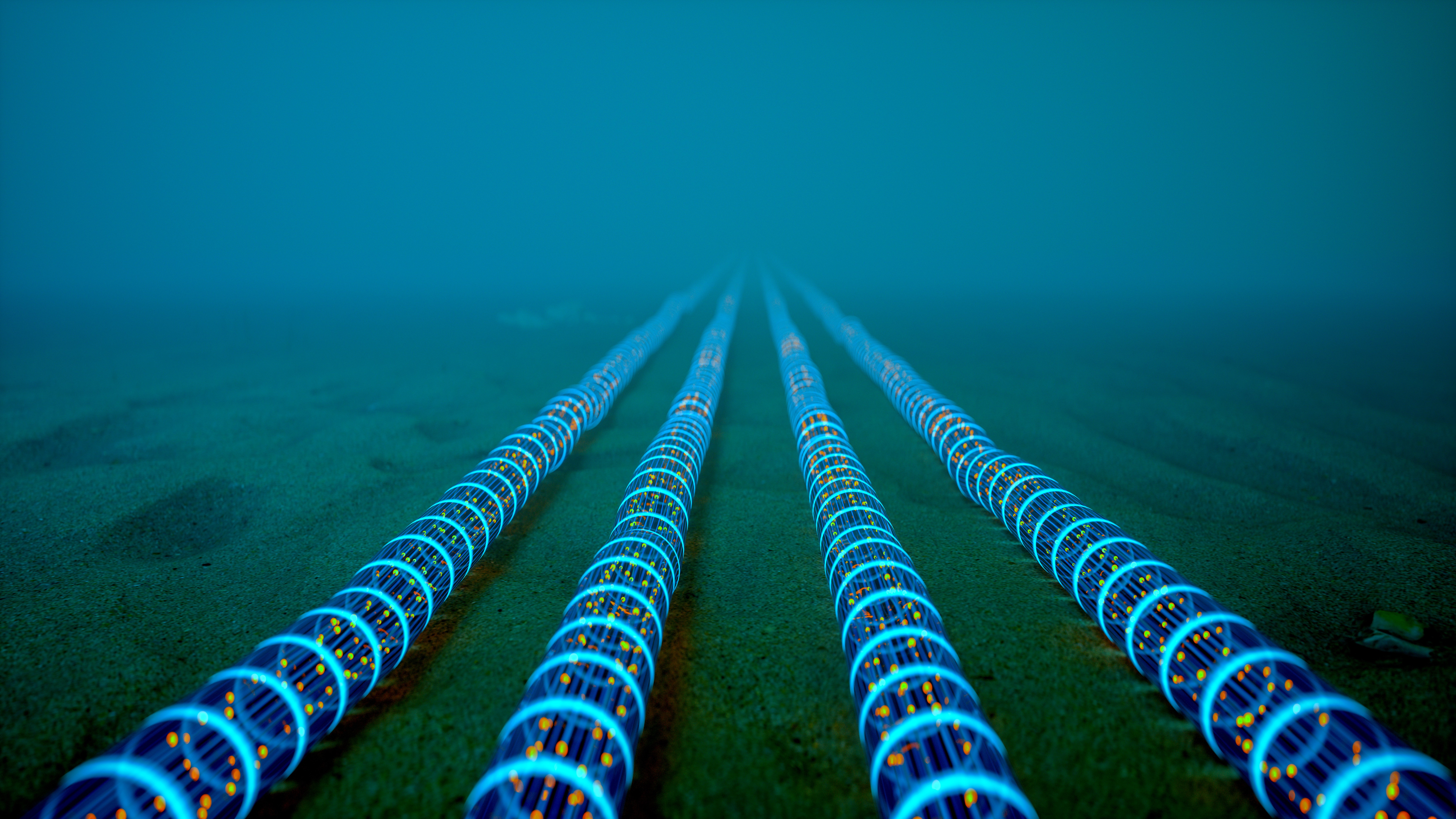
Photo Credit: Imaginima - iStock
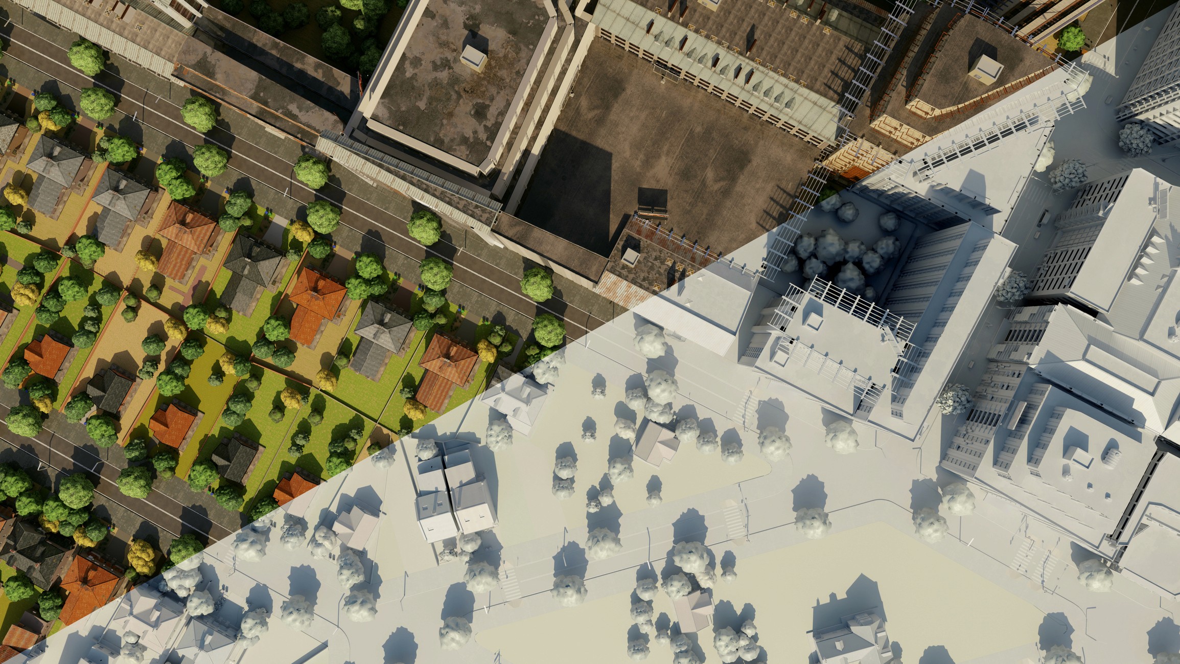
Maritime and coastal infrastructure is quietly becoming one of the most important testbeds for climate resilience and security. Undersea cables carry roughly 98 percent of global data traffic. Cyclones are intensifying as oceans warm. Coastal cities are layering in green infrastructure to absorb heat, pollution and floodwater. At the same time, new financial tools and autonomous systems are emerging that treat climate risk as something to sense, price and pre fund in near real time.
This week, we are looking at how four seemingly different threads, autonomous underwater vehicles, urban green infrastructure sensing, India’s AI driven cyclone defense and scenario planning for parametric insurance, all point to the same story. Infrastructure at the edge of land and sea is being rewired into a stack of autonomous intelligence, climate aligned finance and nature based design.
We will break down what is happening, why it matters for infrastructure owners and operators and where this convergence is likely to go next.
The Invisible Backbone Of Coastal Infrastructure
The first piece of this story sits far below the surface. Undersea cables and subsea assets are the invisible backbone that keeps global trade, finance and logistics online. The EUROATLAS announcement of its GREYSHARK autonomous underwater vehicles (AUVs) makes the stakes very clear, and very digital.
According to EUROATLAS, around 98 percent of international data, from payments and cloud traffic to secure government communications, travels through underwater cables that span more than 1.3 million kilometers of seabed. That same subsea landscape is now a front line for hybrid warfare, sabotage and geopolitical signaling, especially in dense corridors such as the Red Sea, Baltic Sea and the GIUK gap between Greenland, Iceland and the United Kingdom. You can read the full announcement here: EUROATLAS Announces GREYSHARK Autonomous Underwater Vehicles.
At the same time, coastal communities are absorbing the front lines of climate risk. The Cyclone Ditwah coverage, focused on Chennai and the Bay of Bengal, frames cyclones not as one off disasters but as recurring stress tests that require AI driven forecasts, community level financial tools and better land use decisions.
Coastal risk is no longer just a physical planning problem. It is also a financial infrastructure problem. Parametric insurance is emerging as an alternative to slow, claims heavy traditional coverage, especially in coastal zones where risks are rising and many assets are underinsured or uninsurable. A recent scenario piece from Prism lays out how parametric insurance can either “atrophy” into mistrusted products or “ascend” into a central pillar of community level resilience.
Taken together, these sources show a clear trend. Resilience at the coastal edge is shifting from static, concrete centric projects toward dynamic, data driven systems that constantly scan, price and respond to risk.
Data, Autonomy And Green Infrastructure At The Edge
Zooming in, each article shows a different layer of the emerging resilience stack, from deep water ISR to curbside tree health.
Autonomous ISR For Subsea Infrastructure
EUROATLAS’ GREYSHARK AUVs are purpose built for long range, high endurance underwater ISR missions. The Bravo and Foxtrot variants carry an integrated sensor suite of 17 sensors per vehicle, continuously collecting data on the integrity of undersea cables, pipelines and other seabed infrastructure.
A few details matter for infrastructure planners:
Level 5 autonomy means the vehicles can operate under all conditions without human intervention. Missions can be reconfigured remotely mid deployment based on sensor data, for example, shifting from cable surveillance to submarine detection.
Hydrogen fuel cell propulsion on the Foxtrot variant allows up to 16 weeks of underwater operation and up to 11,000 nautical miles at 4 knots without external connection or communication.
Swarm capability enables multiple AUVs to self organize or operate under a mothership, providing both coverage and deterrence in choke points such as the Baltic or Red Sea.
Interoperability with a broader “combat cloud” links these AUVs to submarines, surface vessels and land based communication towers, turning scattered assets into a coherent sensing network.
For ports, cable operators and energy companies, this is a glimpse of where subsea infrastructure protection is heading: persistent, autonomous sensing that reduces human risk while increasing fidelity and response times.
Smelling And Seeing Urban Green Infrastructure
On the streets above, a very different kind of sensing is evolving. A recent study published on PubMed proposes a mobile monitoring system for urban green infrastructure using an electronic nose, thermal imaging and computer vision algorithms. The team mounted an integrated “E nose” and visible thermal camera system on a vehicle roof and drove past 172 elm trees along Royal Parade in Melbourne.
By combining gas sensor data from nine volatile organic compounds, vegetation indices such as effective leaf area index and infrared index, canopy temperature and a tree water stress index, and local meteorological conditions, the researchers could model strong correlations between air contaminants, ambient conditions and plant growth status in real time.
This matters for coastal infrastructure for a simple reason. Urban trees, parks and green corridors are increasingly used as “sponge” systems that manage floodwater, lower temperatures and improve air quality in the very districts that will also be hit by coastal storms. If you can quantify the health and performance of that green infrastructure with mobile, low cost sensors, you can start to treat those assets as part of an infrastructure network, not just as aesthetic add ons.
Hyper Local Cyclone Intelligence And Nature Based Defenses
The Cyclone Ditwah piece in India takes the sensing story and adds two more layers, AI and financial innovation. The article highlights several shifts that are likely to expand globally in cyclone and hurricane exposed regions:
AI driven hyper local risk assessments that move beyond “a cyclone is coming” toward street level probabilities based on elevation data, building materials and historic flood patterns.
Use of satellite imagery during events to identify damaged infrastructure in real time and prioritize rescue and repair efforts.
Parametric policies and microfinance partnerships that bundle climate resilient housing loans with indexed insurance coverage, speeding up recovery for households that would otherwise struggle with premiums or long claims processes.
Nature based defenses such as mangrove restoration, artificial reefs and “sponge city” designs that reduce surge energy and improve flood absorption before a storm even lands.
Experimental adaptive systems like floating farms in the Sundarbans that rise and fall with tidal cycles, pointing to a future where communities adapt to water rather than constantly fighting it.
You can dive into the full exploration here: Cyclone Ditwah & Climate Change: Preparing For More Intense Storms.
What is important from an infrastructure perspective is not just the technology, but the shift in mindset. Cyclones are no longer treated as one off emergencies. They are recurring stress events around which financial products, land use plans and ecosystem strategies are being intentionally designed.
Parametric Finance As Climate Infrastructure
The Prism scenario article on parametric insurance pulls these threads into a financial frame. At its core, parametric insurance replaces slow, loss adjusted claims with pre agreed triggers. When wind speed, wave height or flood depth crosses a threshold, a payout occurs. No adjusters walking neighborhoods, no months of paperwork. That simple design opens up a set of possibilities for coastal infrastructure:
Clear, objective indices such as hurricane category, storm surge height or rainfall intensity.
Trigger thresholds calibrated to local conditions, for example, a surge over two meters in a designated area.
Payout structures that scale with severity, so a Category 5 event unlocks more capital than a Category 3.
Data sources pulled from trusted meteorological agencies, satellites and catastrophe modeling firms.
The article uses two contrasting scenarios to illustrate the stakes.
In an “Atrophy” future, poor policy design and opaque triggers generate mistrust. Basis risk, the gap between index behavior and real world damage, leads to communities who suffer losses without payouts. Data gaps and unequal access leave low income areas exposed. In that world, parametric products become another layer of frustration rather than a resilience tool.
In an “Ascend” future, parametric coverage is co designed with communities, supported by strong data infrastructure and deployed alongside nature based solutions. IoT sensors and satellites feed real time indices. Microinsurance models and subsidies keep premiums affordable. Ecosystem based policies protect mangroves and coral reefs by tying payouts to environmental health indicators.
That second scenario looks a lot like the direction the cyclone and AUV stories are pointing. Infrastructure is treated as a portfolio of interdependent systems, many of them invisible, where financial tools and technical sensing work together.
Implications For Infrastructure Owners, Cities And Operators
So what does all of this mean for the people building and managing infrastructure at the coastal edge, from ports and utilities to city governments and investors
Here are a few clear implications:
Undersea and coastal digital infrastructure should be treated as critical public utilities, not niche telecom assets.
GREYSHARK and similar AUV programs signal that subsea cables and pipelines are now squarely in the national security and resilience conversation. Infrastructure planners need to map their dependencies on undersea infrastructure and factor in ISR capabilities, not just on land but underwater.Green infrastructure is now a measurable, monitorable part of the resilience stack.
The E nose and computer vision work in Melbourne shows that cities can track tree health and air quality in near real time with mobile platforms. For coastal districts, this opens the door to performance based design for green corridors, wetlands and other soft defenses that complement seawalls, levees and breakwaters.Resilience plans need an explicit financial layer.
The Cyclone Ditwah and Prism pieces both emphasize that infrastructure damage is also a liquidity problem. Parametric products, risk pools and microinsurance can be designed to trigger capital flows precisely when ports, utilities and local governments need them most. That requires collaboration between infrastructure owners, insurers and regulators well before the next storm season.Community engagement is a resilience asset, not just a communications task.
Both the Atrophy and Ascend scenarios hinge on trust. If communities do not understand triggers or feel coverage is inequitable, parametric solutions will struggle. Participatory design, clear communication and local intermediaries will shape whether these tools deepen resilience or widen inequality.Nature based solutions should be quantified, insured and integrated, not treated as side projects.
Mangroves, wetlands, reefs and urban green spaces can all be incorporated into parametric and traditional insurance models as risk reduction assets. That creates incentives to protect and restore them and aligns environmental goals with financial performance.
For readers of our previous infrastructure piece on how cities are entering a climate resilient, data driven era, this is the coastal extension of that story. The same logic applies. Better data, smarter finance and more intentional design are turning “resilience” from a buzzword into an operating model.
Future Outlook: The Coastal Resilience Stack In 2030
Looking out toward 2030, it is not hard to imagine a coastal region where all of these elements operate together:
Swarms of hydrogen powered AUVs patrol subsea corridors, inspecting undersea cables and pipelines, feeding status data into national grid and telecom operators.
Urban service vehicles carry integrated sensor arrays, scanning tree health, air quality and surface temperatures along coastal boulevards while performing routine routes.
AI platforms combine this edge data with satellite feeds and climate models to provide hyper local risk dashboards for cities, ports and utilities.
Parametric insurance policies sit on top of this data, with triggers tied to wave heights, surge depths, wind speeds and even ecosystem health indicators. When a cyclone or storm hits, capital arrives in days, not months.
Nature based defenses such as mangrove belts, living shorelines and reef structures are treated as insurable infrastructure. Investment flows into restoration because it directly reduces premiums and risk.
Communities understand how their coverage works, because policies were built with their input. Local cooperatives and microfinance institutions help bundle coverage with housing upgrades and small business support.
We will not get that future by accident. It will come from deliberate decisions by infrastructure owners, public agencies, investors and communities to connect technical, financial and ecological strategies, rather than tackling them in silos.
Infrastructure at the water’s edge is entering a new phase. Undersea cables that carry global data, coastal green corridors that cool and absorb floods and climate stressed communities in cyclone and hurricane zones are all converging on the same set of ideas. Continuous sensing, AI driven modeling, smart financial triggers and nature based defenses that act as co equal infrastructure.
From GREYSHARK’s autonomous underwater ISR to E nose powered urban tree monitoring, from Cyclone Ditwah’s AI enhanced evacuation and insurance efforts to scenario planning for parametric coverage, the common thread is clear. Resilience is becoming embedded, automated and, ideally, more equitable.
The open question for infrastructure stakeholders is which scenario we move toward. Atrophy, where mistrust, data gaps and inequity erode the promise of these tools. Or Ascend, where technology, finance and ecosystems are aligned to protect the invisible backbone we all rely on.
As infrastructure, real estate and smart city leaders plan the next decade of investment, the coastal edge is where that choice will become very visible.